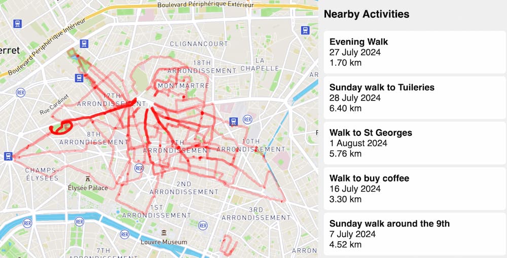
Putting my Strava activities on a single map
I’m excited to share a small project I’ve been working on: a web app that takes your Strava workout activiites and puts them on a single map using Astro, the Strava API and the Mapbox SDK.
After moving to Paris in early May this year, I have been walking a lot, as a way to stay healthy and to explore Paris and learn about its geography. I’ve been walking around the 18th, 9th, 10th and 11th arrondissements in particular.
I thought it would be interesting to make a small web app that takes my Strava activities and renders them on a single map, as a way to visualise the areas that I have been exploring, and encourage myself to check out more.
Here’s a screenshot of my activities on a map:

Decoding polyline strings
When you retrieve your list of activities from the Strava API, it returns the map information as a long encoded string:
{
"map" : {
    "id" : "a1410355832",
    "polyline" : "ki{eFvqfiVqAWQIGEEKAYJgBVqDJ{BHa@jAkNJw@Pw@V{APs@^aABQAOEQGKoJ_FuJkFqAo@{A}@sH{D...",
    "resource_state" : 3,
    "summary_polyline" : "ki{eFvqfiVsBmA`Feh@qg@iX`B}JeCcCqGjIq~@kf@cM{KeHeX`@_GdGkSeBiXtB}YuEkPwFyDeAzAe@..."
  },
}
These encoded strings follow the Encoded Polyline Algorithm Format. I used the @mapbox/polyline npm library to turn these strings into coordinates that can be rendered on a map.
Aider’s AI pair programming
I’ve been using Aider a lot in the last couple of weeks. It’s an open-source AI coding assistant that lives in the terminal. I’ve been using it with Anthropic’s Claude 3.5 Sonnet model and I’ve been really impressed with the results. It’s been a big productivity boost to help me get stuff done.
Check out the GitHub repo
If you’re curious about how this project works and want to give it a try, check out the GitHub repository for more details and the source code.